When Ullrich Jasper Seetzen visited Dilli on 18 December 1805, it was uninhabited.
Already in the old literature of the 19th century Dilli, or the swamps at Dilli is named as the starting point of the Qanat Fir'aun.
In fact, the name "Dilli" is the same in all literature and the old maps, this is unusual because of the very different transcriptions of travelers from the arabic language.
However, the Roman dam seems to have been allready destroyed at the time of U. J. Seetzens visit, since he described even at this water-rich season no water surface, or even crossing. He describes a brook and the reed-covered flat area of the former lake, through which wild pigs pulled.
However, until 2007 there was no description or pictures of the dam until the Qanat Fir'aun Survey Team drove through the Village of Dilli.
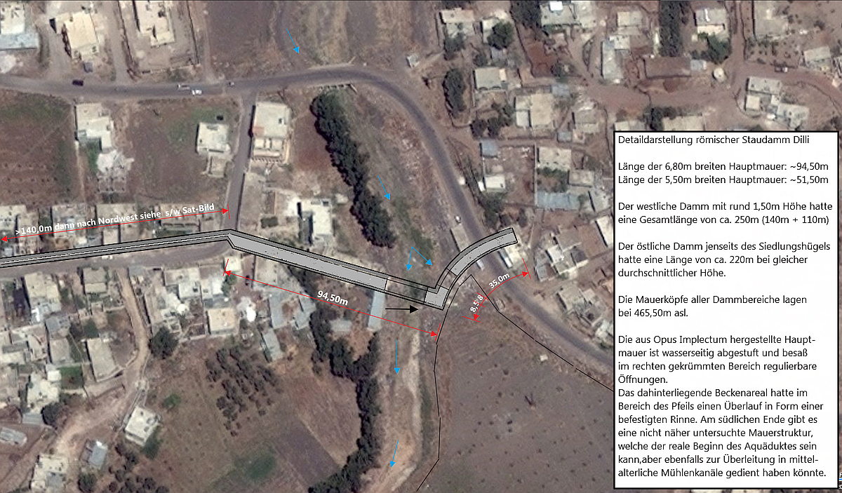 Rekonstruktion des Dammes (Westseite) Stand 2011 / Bild © Google-Earth 2008
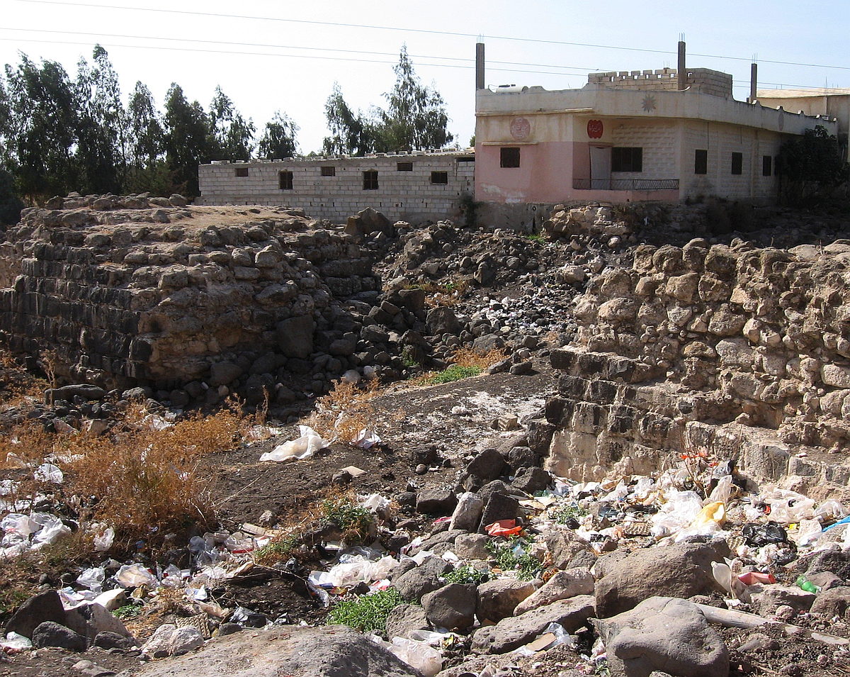 Ansicht von Ost
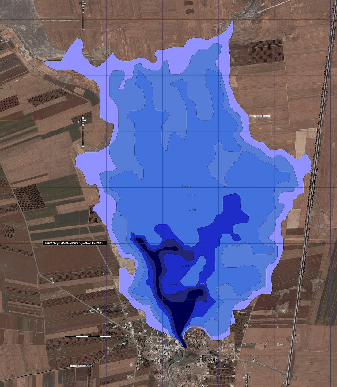
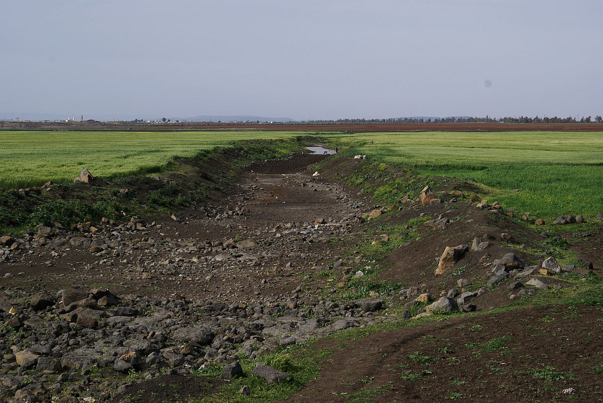 Stauseeareal, Blick in Richtung Norden
Here were found remains of an old dam of Roman type and upstreams a meanwhile largely agricultural used reservoir area. Using my own measurements and SRTM data provided by NASA, I was able to make calculations on the former size, congestion heights and corresponding volumes. (see also left)

The illustration (left) already clearly shows that in addition to the actual dam wall, further ramparts and restraints were available. The data shown here (below) and calculations taken during further measurements (2010) and additional altitude data, shown on an old satellite image, show the almost complete extent of the congestion facilities as lines. In my estimation, the selection of exactly this satellite image is particularly concise, since these calculated wall structures actually emerge as surface contours in the picture. From the eastern dam, the foundation areas are still preserved in parts. The western dam area has disappeared in the modern village structures. The lake side originally graded dam side of the main embankment is still clearly recognizable by the bend in the main wall. The originally adjustable opening (sluice gate) in the curved part (here runs a curved basalt tongue used as a foundation) along the main wall, was apparently later expanded and provided the inflow to a 1.5 ha area, which could be dammed separately at least up to 2m ( > 30000m³) and lays 1.50m above the actual riverbed. Whether this already existed in Roman times is unknown, but from the soil structure it seems to have been used as a retention basin until the 20th century and could thus supply downstreams lying mills. (see also S / W satellite image of the University of Maryland below).
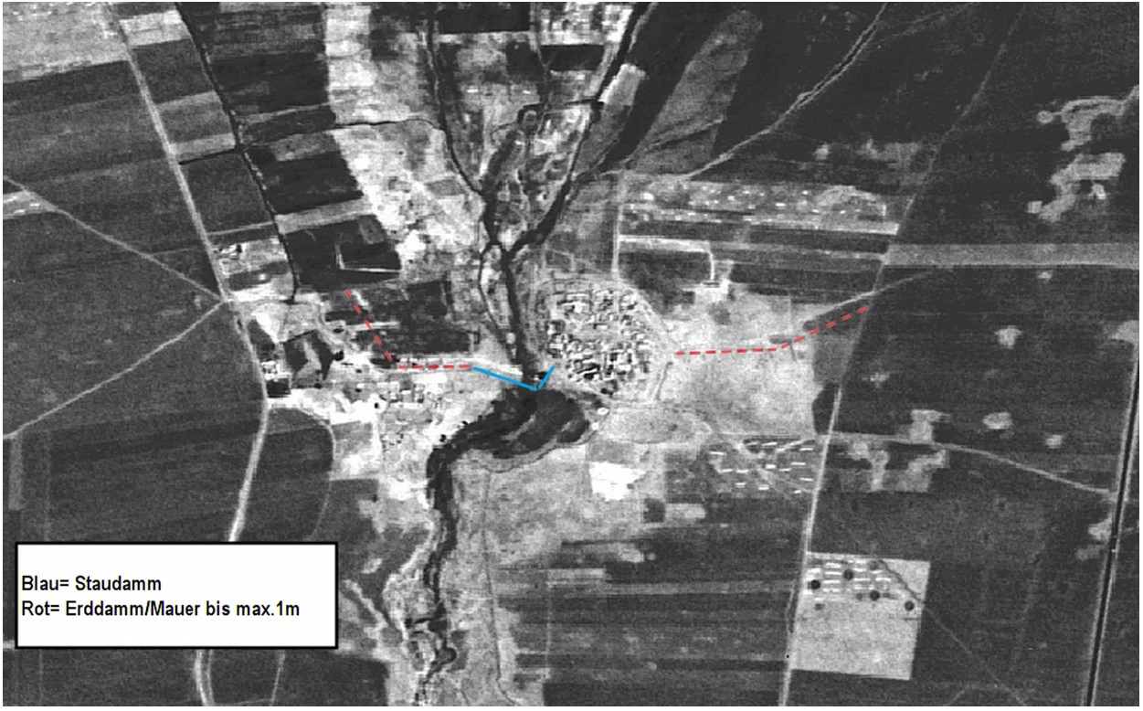 s/w Sat.-Bild 1978 mit deutlich erkennbaren Verläufen
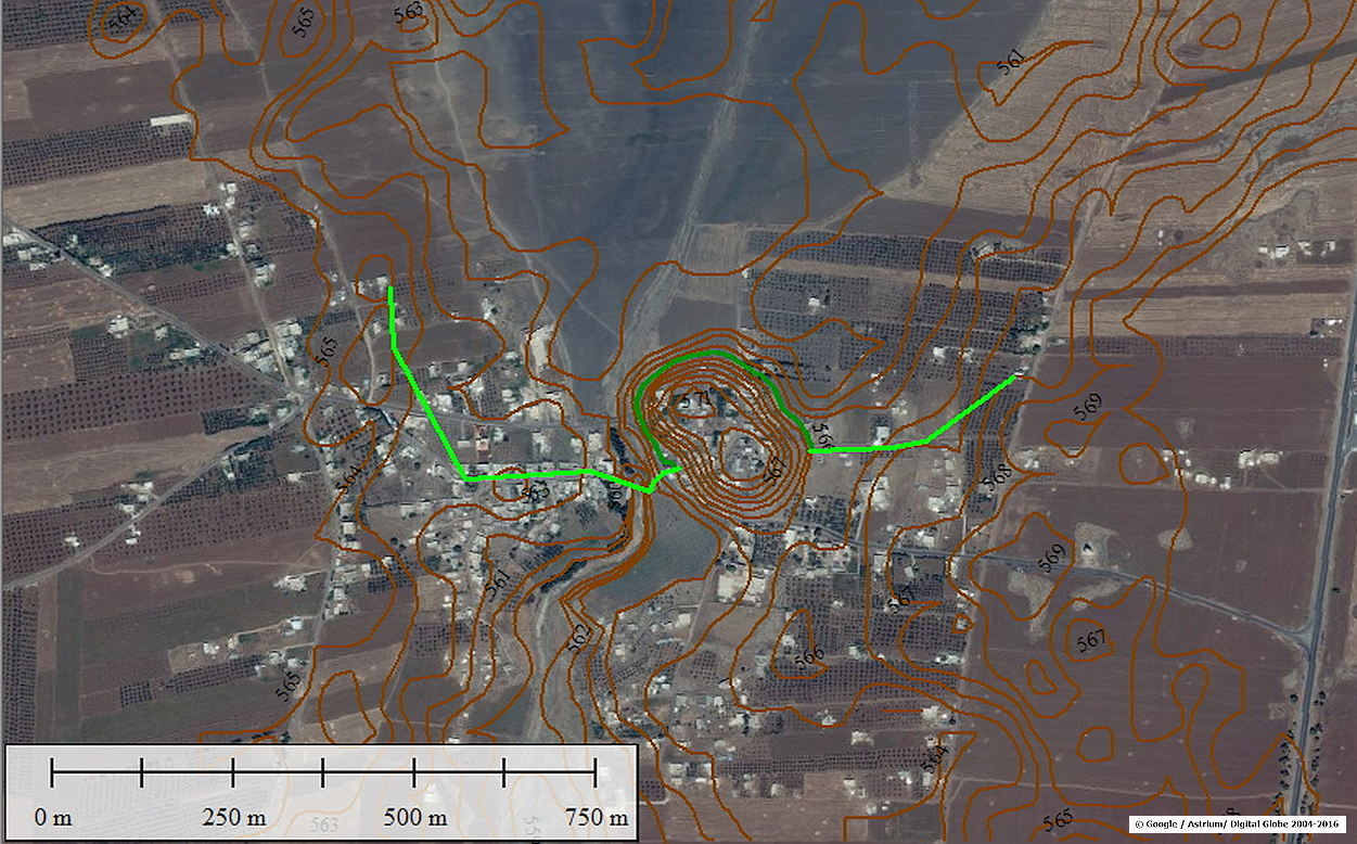 gleicher Ausschnitt mit Dammverlauf und Höhenlinien
For a basin that already existed in Roman times,speeks that the remainder of a gutter lying directly behind the wall, much higher than the actual riverbed, of which at status quo only Opus Cementicium remnants are left. This unusual point can not be explained as a scour protection behind the wall, as proposed for example by M.Döring. This proposed under a main overflow protection would then rather in the riverbed, actually as described by M.Döring at the lowest point and not as clearly detectable, next to the gutter and much higher. These remains formed with high probability an overflow of a seperate storage/settling basin into the river.
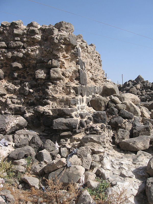 Reste der Überlaufrinne vom höhergelegenen Areal/Becken ( Position und Blickrichtung siehe schwarzer Pfeil im Bild ganz oben)
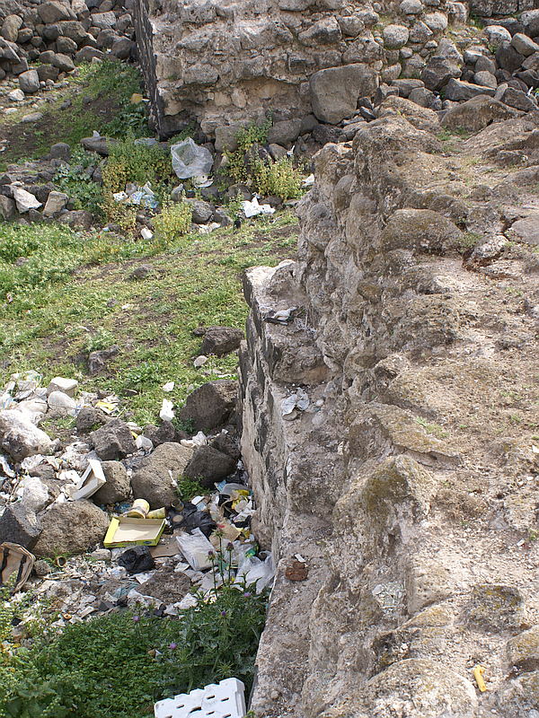 gekrümmter Mauerverlauf mit bereits herausgebrochenem Schalenmauerwerk des Opus Implectum
The Qanat Fir'aun leads further south, more information about the following section you will get here.